How to Hike the Slot Canyon Trail in Borrego Springs
Hey! Quick note: This page contains affiliate links. If you buy through them, I may earn a small commission at no extra cost to you. As an Amazon Associate, I earn from qualifying purchases.
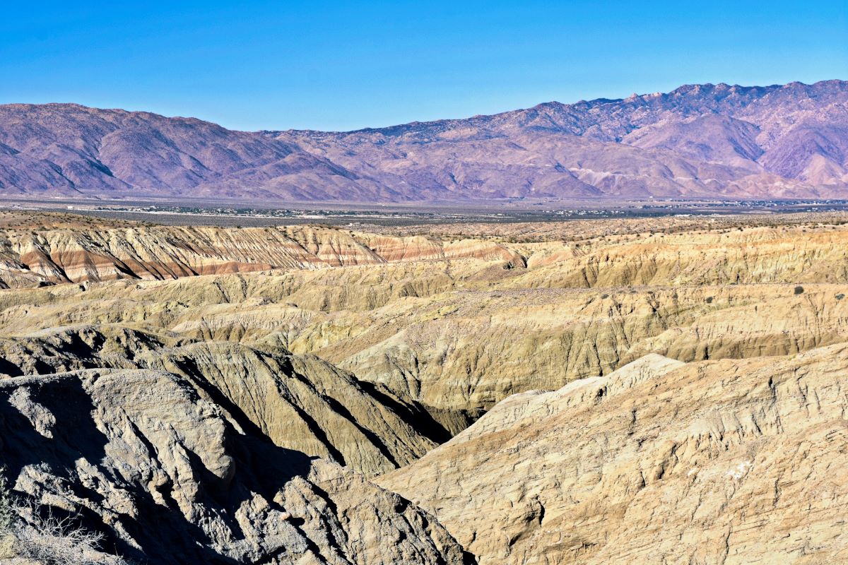
The Slot Canyon Trail in Borrego Springs, California, is a unique hiking destination that winds through the Anza-Borrego Desert State Park.
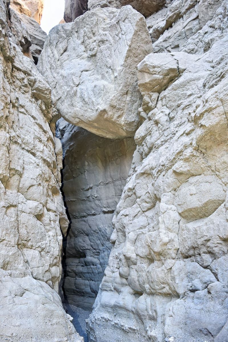
This trail is around two miles long and takes you through a canyon with towering rock walls on either side. It’s a fun hiking experience since the trail has several narrow passages that require you to squeeze through. It felt like we were navigating through a maze.
If you’ve hiked Annie’s Canyon in San Diego, it reminded me of that, but this trail is a mega version.
Slot Canyon Trail Quick Summary
Length: 2.2 miles
Difficulty: Easy to Moderate
Time to complete: 1.5 – 2 hours
Cost: $10 cash or check
Kid Friendly: Yes
Dog Friendly: Not allowed
Cell Service: No service for most of the hike
Tip: A 4WD vehicle is recommended for the sandy road
Where is the Slot Canyon Trail?
We stayed near Christmas Circle in Borrego Springs, and it took us about 20 minutes to drive to the trailhead.
We missed the turn the first time and had to turn around. If you’re heading east on CA-78, keep your eyes open for signs a couple hundred feet from the road on the left side.
It’s a little easier to spot when you’re heading west since there is a Buttes Pass sign just before you have to turn right.
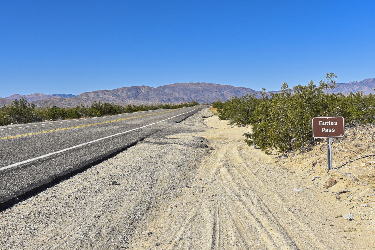
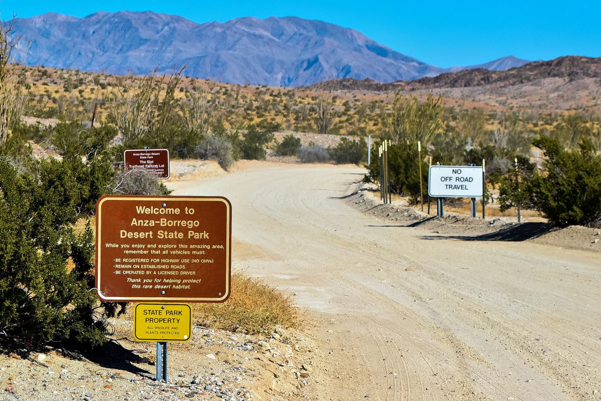
Once on the sandy road, you’ll drive a few minutes before seeing the parking area, bathrooms, and fee collection box. The road is narrow, and we pulled over a few times on our way out to let other cars squeak through.
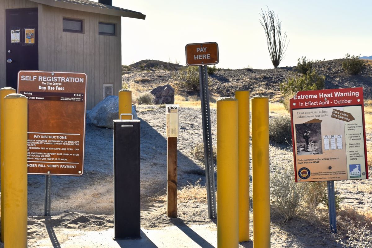
How much does it cost?
The Anza-Borrego Desert State Park fee is $10. You must bring cash or a check to place in an envelope that goes into a drop box. The envelope has a detachable stub to stick on your car window so the rangers can verify you paid. We only had a $20 bill, so they got a small donation.
When to arrive
It’s true what they say: the early bird catches the worm, or in this case, beats the crowds and the heat! We arrived at the hiking spot a little before 8 a.m. and found only two other cars parked.
During most of our hike, we were by ourselves and only crossed paths with the same person a couple of times. Toward the end of the hike, we passed two families just starting theirs.
Be aware that there are several tight and narrow areas along the way, so if there are lots of people, you’ll have to take turns passing through as it gets crowded.
Starting early has its advantages, especially in avoiding the heat. We went the second weekend in November, and it was chilly at the start but got toasty towards the middle of the hike, especially in the sun.
It was 9:45 a.m. when we returned to our car, and we saw seven more cars parked. On our way out, we drove past multiple cars making their way to the trailhead.
I don’t think I would’ve enjoyed it as much if we arrived much later. So, if you can, try arriving by 8 a.m. or even earlier if you’re a go-getter!
Exploring the Slot Canyon Trail
Before you drive to the trail, download or print the trail map. We lost cell service during most of the hike.
Trail Map
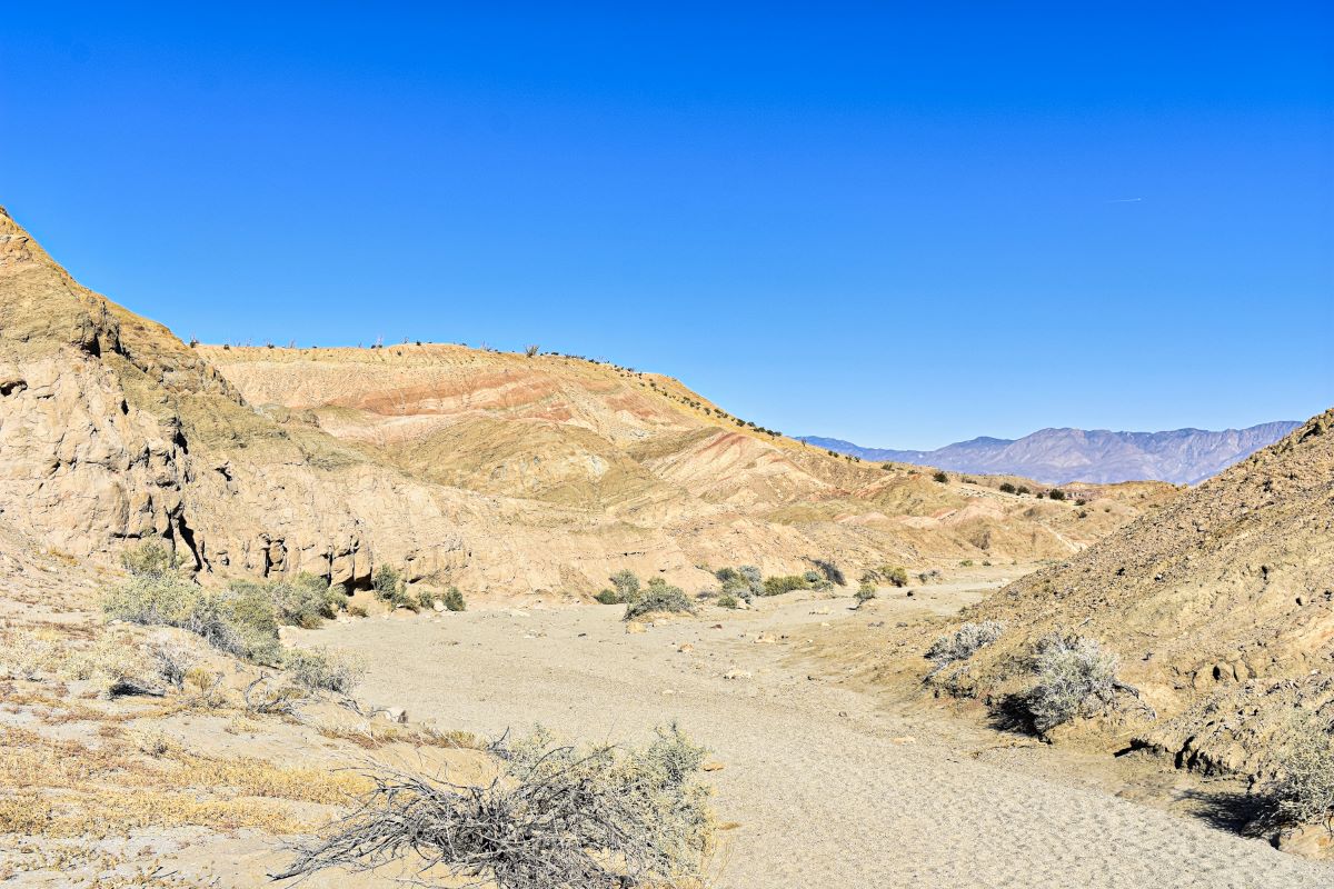
You can either do the whole 2.2-mile loop or turn around between markers 7 and 8 and work your way back through the canyon, which we decided to do. We weren’t sure how to navigate the loop, and going back through the canyon seemed like the cooler option since it was more shaded.
Difficulty
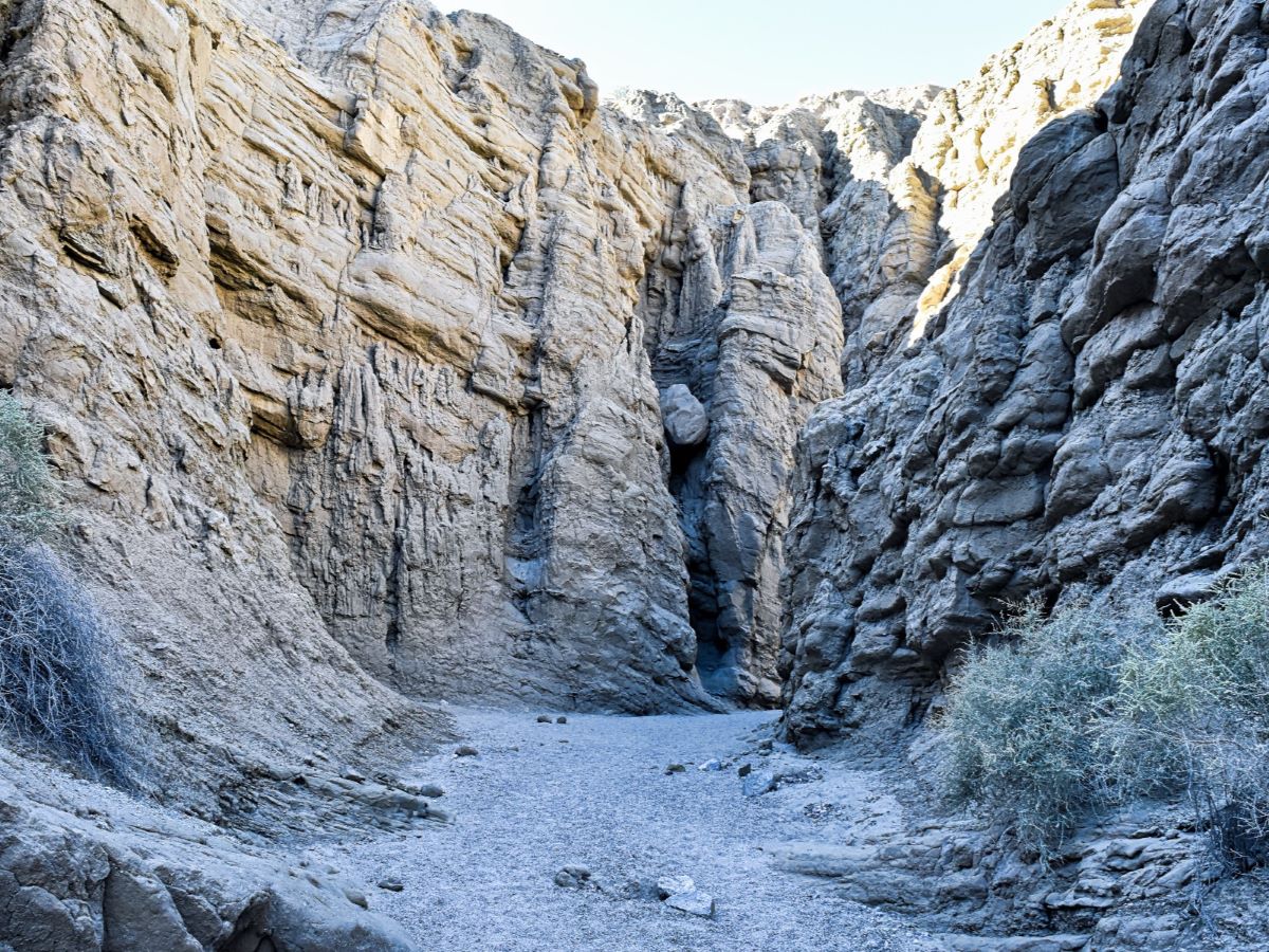
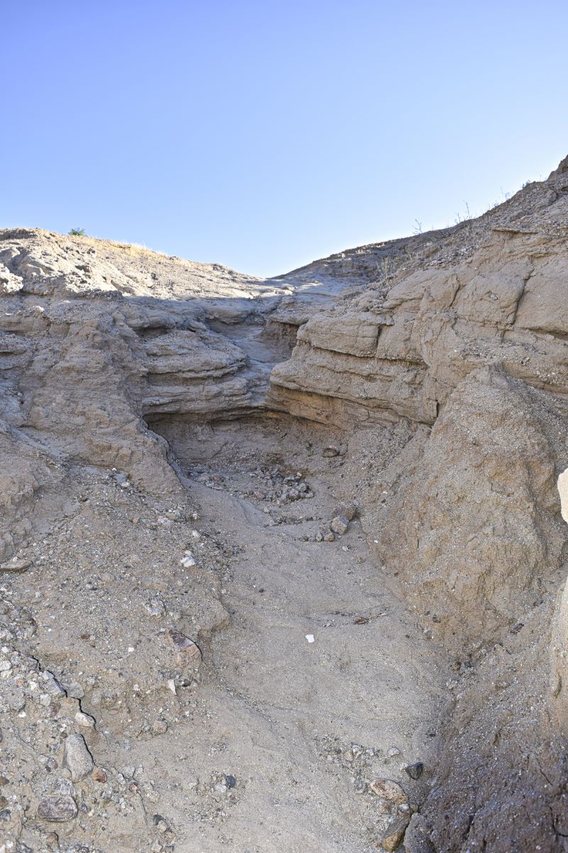
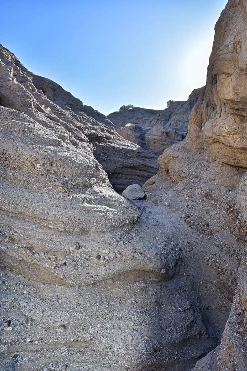
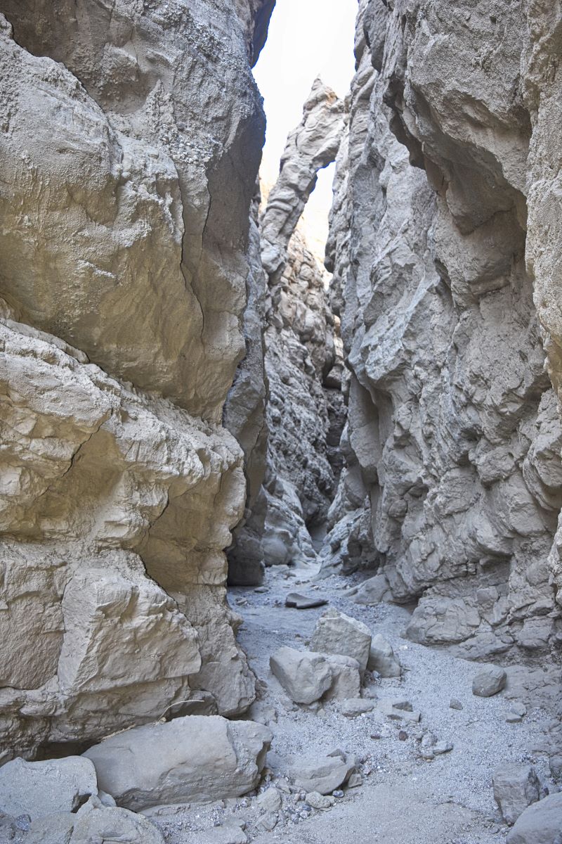
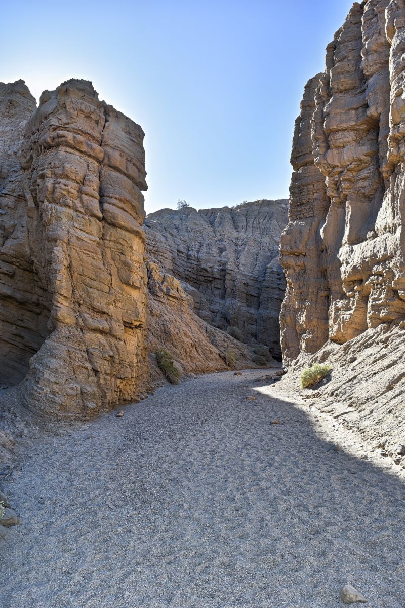
The Slot Canyon Trail is easy to moderate. Most of it was an easy walk with some tight squeezes through the canyon. After going through all of the narrow passages, the open parts of the trail are sandier, so it feels like you’re walking on a beach.
There were a couple of areas with large rocks that were a bit tricky to navigate, and my husband had to help both me and my son down. I had a backpack on and a camera around my neck, so that made these spots a little harder for me. Otherwise, I could have figured out a way to get down on my own.
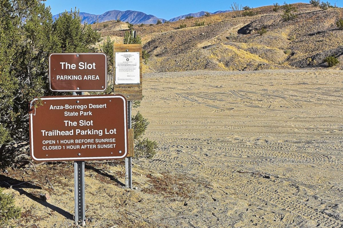
Trailhead
Not far from the parking lot, you’ll see the signs for the trailhead. If your back faces the CA-78 highway, it will be to your right.
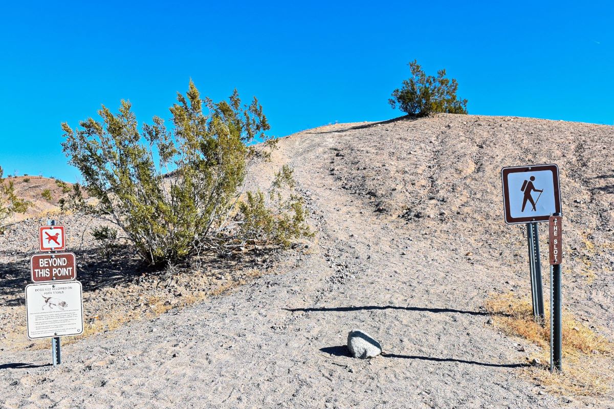
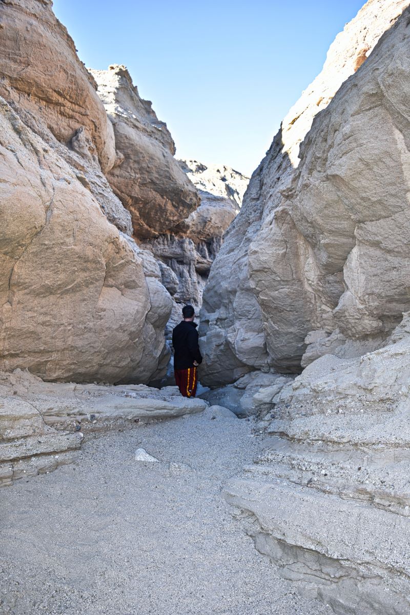
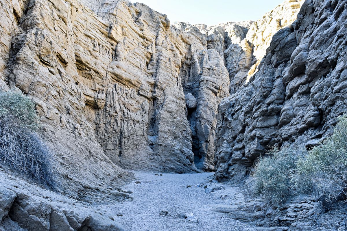
Heading into the canyon
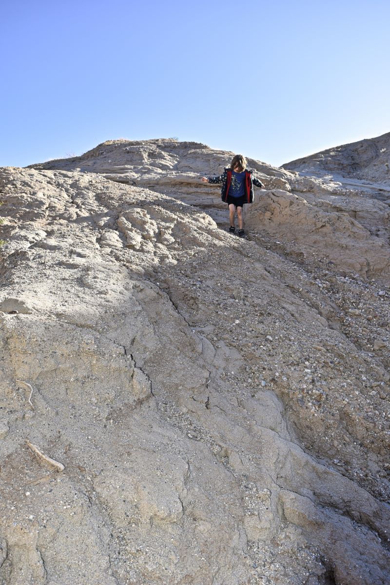
At the start of the hike, you’ll see that you’re at the top of the canyon.
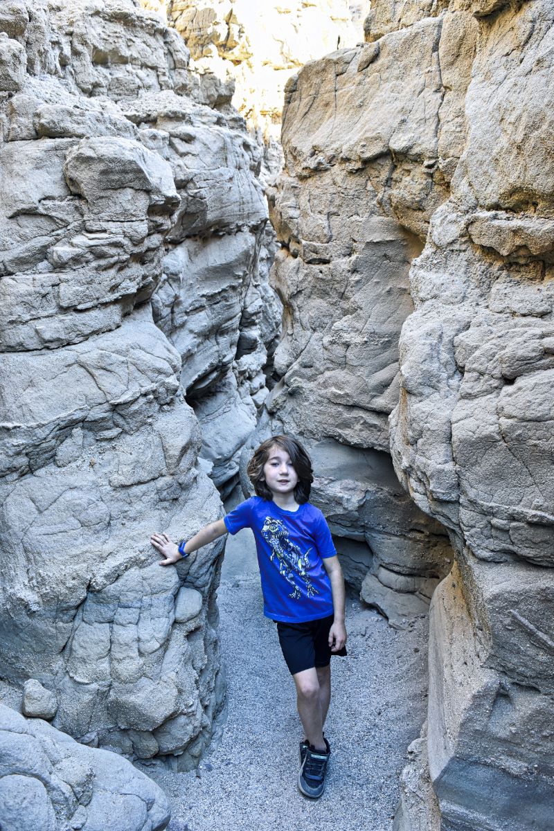
From there, you’ll make your way down pretty quickly, and there’s a couple ways to go. My son chose the more dangerous, direct option, while my husband and I took the easier path.
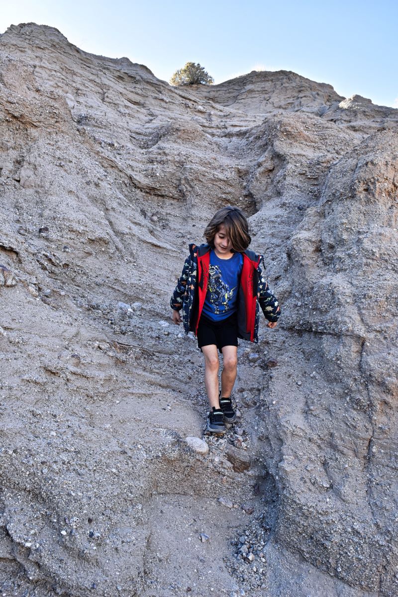
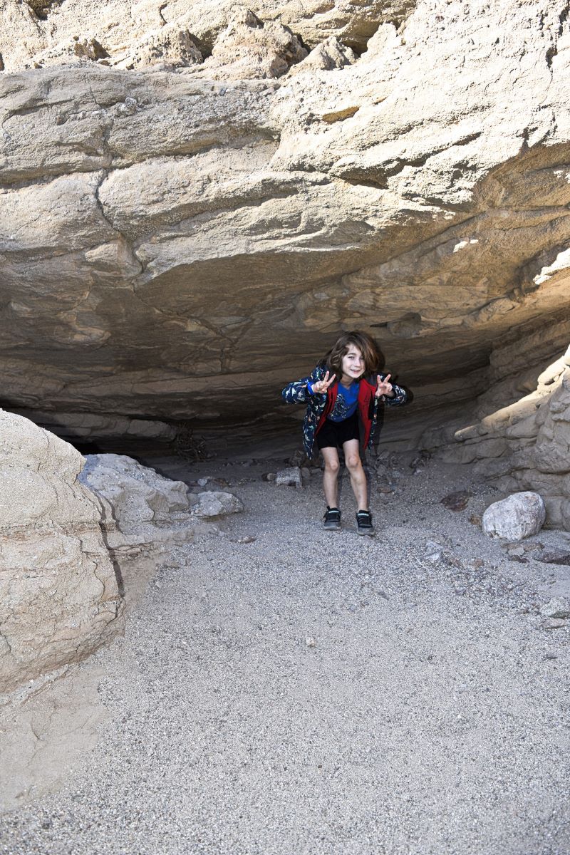
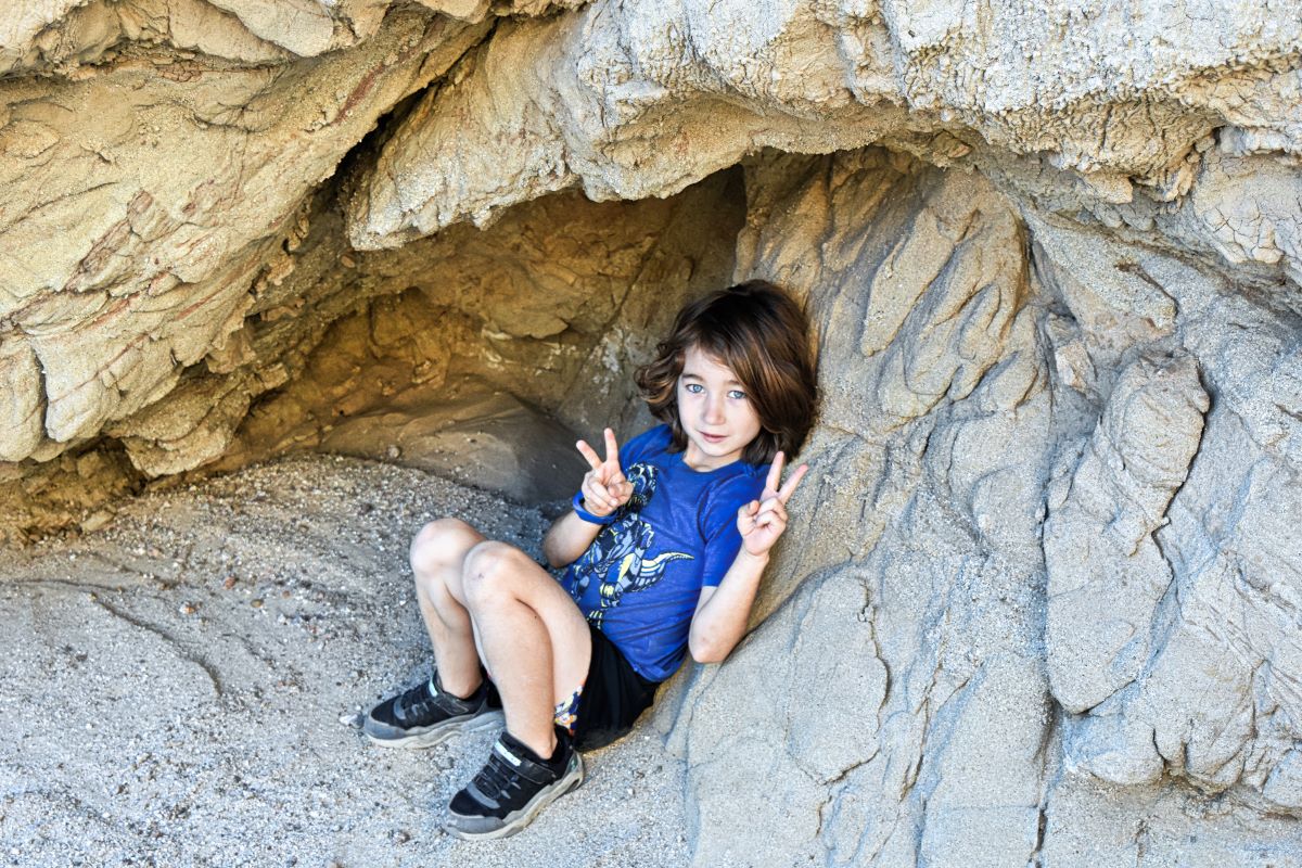
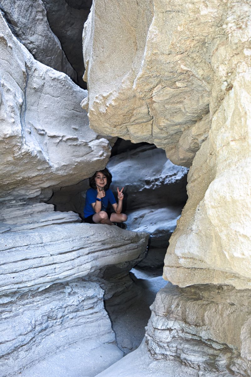
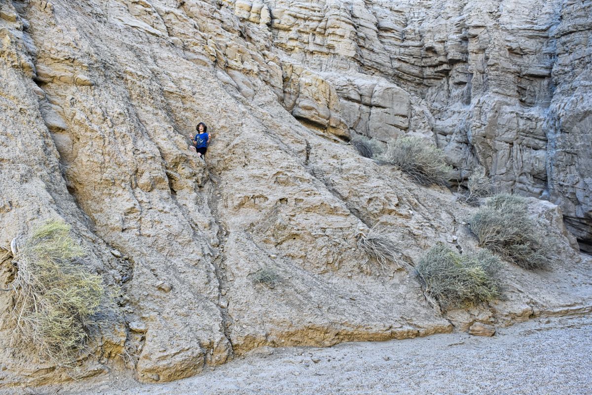
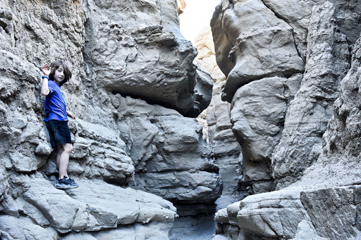
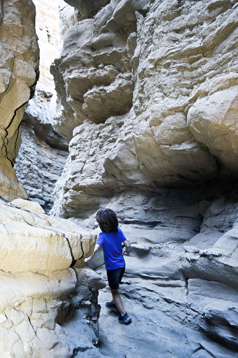
Nooks and crannies
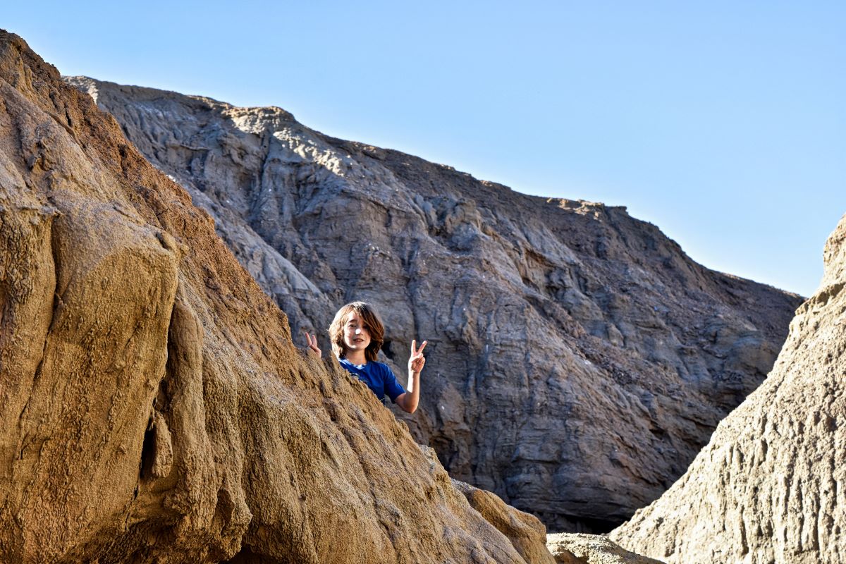
My daredevil son was thrilled as he climbed up the rock walls and went in and out of small hideouts. Although it wasn’t the safest thing for him to do and made me a little nervous, he had a blast.
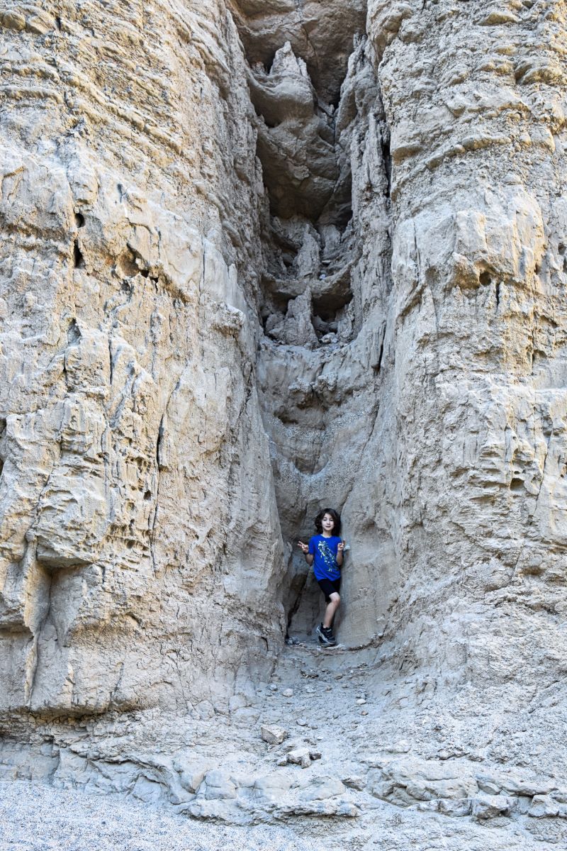
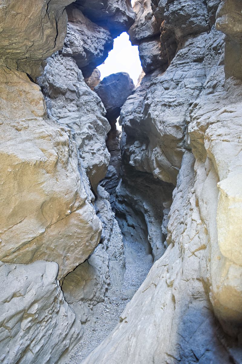
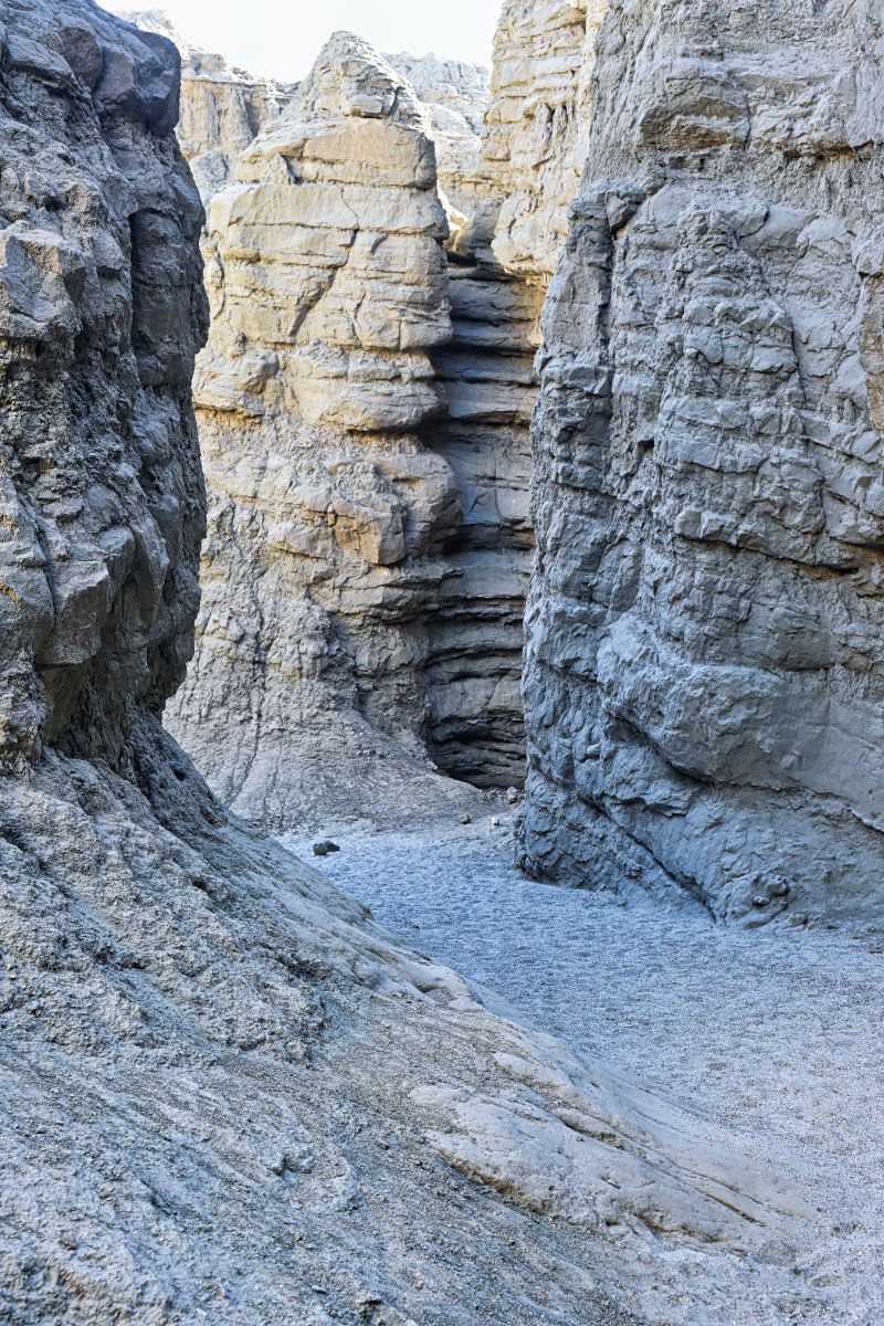
Narrow passages
I knew the slots would get narrow, but I was still surprised at how small a few of them were. I had to take my backpack off to squeeze through some.
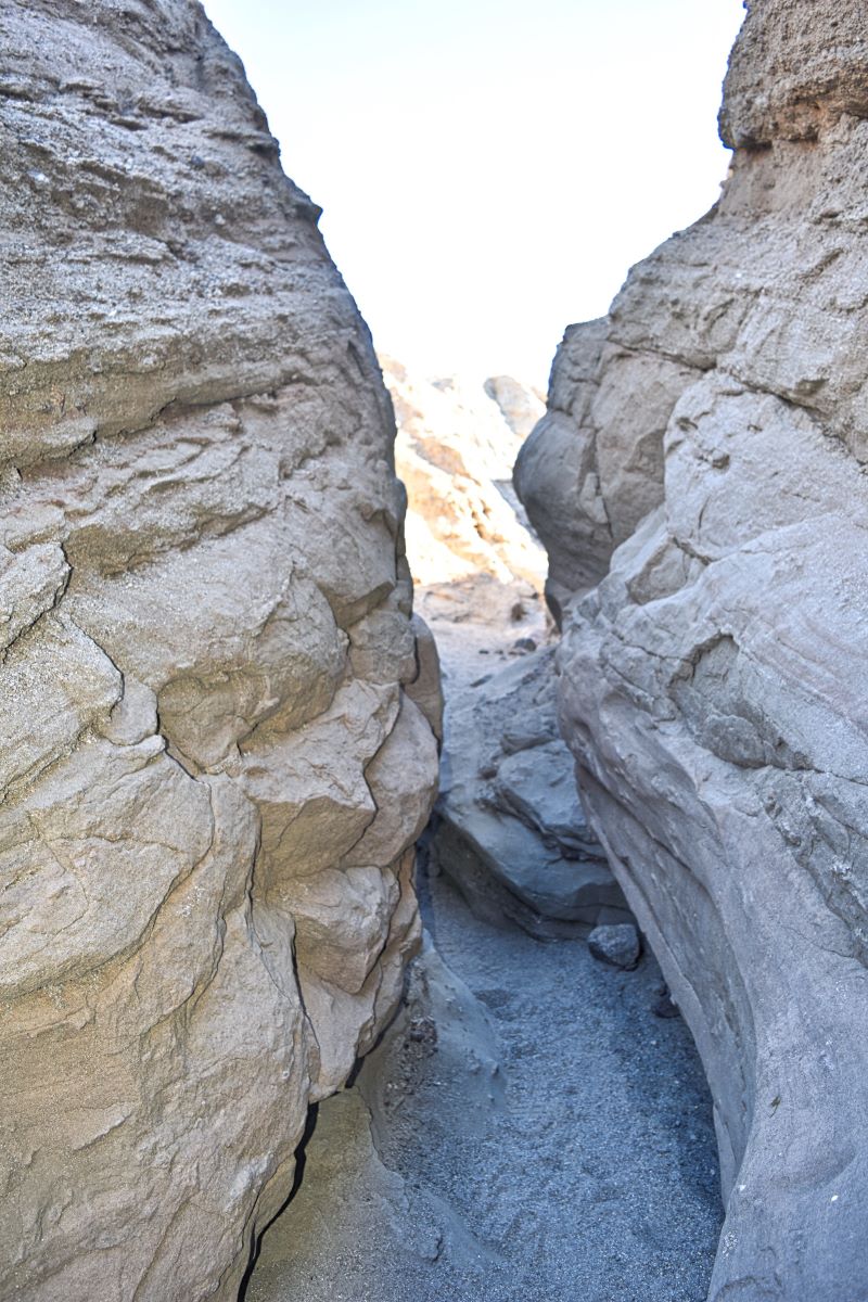
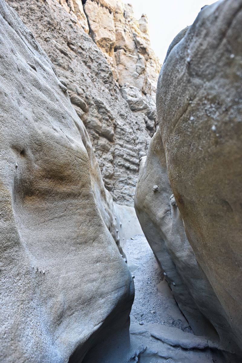
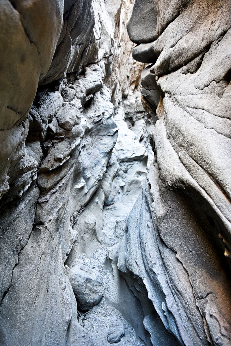
Our clothes got dirty from rubbing against the walls, but dusting off when we were done was easy.
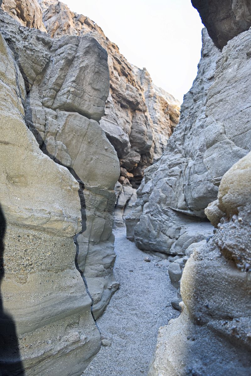
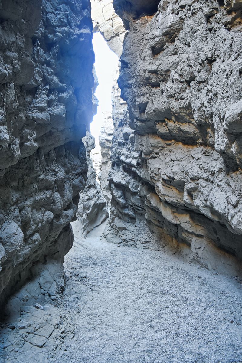
Back out in the open
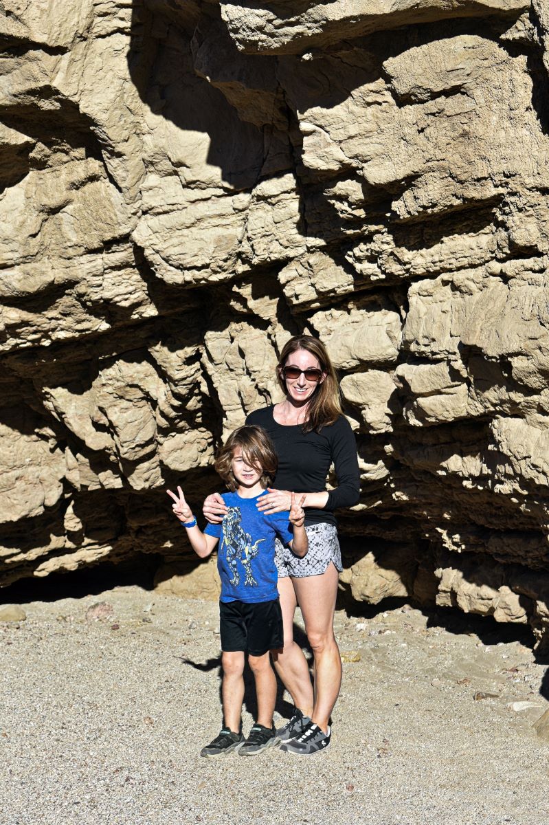
Once you go through all the narrow passages, the trail opens up, and there are more incredible, tall rock walls. This is between markers 7 and 8 on the trail map.
As you can see in the last picture, there was no shade, so that’s where we turned around and went back through the canyon.
What to bring
The number one thing you should bring is a water bottle. It only took us a little over an hour and a half to complete the hike, so we didn’t drink too much. But you are in a desert, and it can get hot, so it’s always a good idea to have some with you.
I also brought a backpack, which was useful for carrying our water bottles, sunscreen, and my son’s jacket when he got hot five minutes after starting the hike.
Other things to do around Borrego Springs
Places to eat
Activities
- Galleta Meadows Sculptures
- Palm Canyon Trail
- Witness the wildflower blooms in the spring
- Wind Caves Trail
- Take a day trip to the Salton Sea
Where to stay
Related posts to help you plan a trip to Borrego Springs
- How to Have the Best Weekend in Borrego Springs, California
- How to Easily See All of the Galleta Meadows Sculptures
- Wildflowers in Anza-Borrego – A Bucket List Worthy Experience!
- Hiking Borrego Palm Canyon Trail: What You Need to Know
- La Casa Del Zorro: Your Ultimate Borrego Springs Retreat